
 Skip to content
 A Georgia developer built a multi-lot hillside subdivision. They fit grading to terrain, balanced cut and fill, phased disturbance, and used drone surveys + GPS machine control. Result: 20–40% less earth moved, faster rough grading, clean permitting.
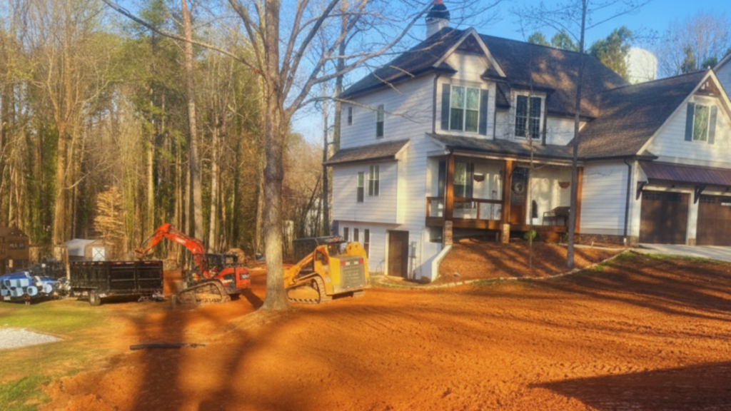
Rolling Piedmont foothills, Georgia—hilly terrain, expansive red clay, heavy rainfall. Project scale: 100-lot subdivision near Atlanta with major elevation changes and on-site streams/buffers. Regulatory drivers: Georgia E&S/GESA standards, NPDES construction permitting (NOI/GAR100003), local Land Disturbance Permit—all demand strict sediment control and rapid stabilization.
Read More: The Land Grading Regulations and Permits in Georgia: The Complete Guide
Large grade changes meant heavy cut/fill volumes and high hauling costs.
Expansive red clay increased erosion and made exposed areas vulnerable during storms.
Streams and buffers constrained grading locations, raising rework risk and permitting delays.
State rules demand rapid stabilization (vegetation/mulch within days) and robust sediment controls.
Fit design to existing topography. Align roads and pads to natural benches to minimize scope of excavation and grading services in notorious atlanta georgia
Balance cut and fill on-site—iterate grading models to reuse excavated material, avoid imports/exports.
Limit clearing and phase work. Expose only what’s needed by coordinating land clearing services with the grading schedule in atlanta ga, protecting tree clusters and buffers.
Read More: Erosion & Sediment Control Best Practices for North Georgia Construction Sites
Integrate stormwater BMPs early—site detention basins, vegetated swales, infiltration features sized to meet water-quality rules.
Adopt surveying + machine control tech—use drone photogrammetry/LiDAR for frequent as-builts and GPS-guided machines for precise grades.
Immediate stabilization & BMP installation—silt fences, inlet protection, rock check dams, hydroseeding/mulching within regulatory timeframes.
Pre-design: Map streams, buffers, tree clusters; run terrain analyses in Civil 3D to test grading alternatives.
Design: Place major BMP (detention pond) at site low point; arrange lots to preserve conservation islands; produce cut/fill optimization iterations.
Permit package: Submit E&S plan and NOI; show buffer avoidance, sediment pond sizing, phased stabilization schedule.
Construction: Mass grade in sequenced blocks, update models weekly with drone surveys, run GPS-controlled dozers to final rough grades.
Stabilize & inspect: Install perimeter controls as grading advances; hydroseed/mulch areas within 10–14 days; maintain inspection logs.
Earthwork reduction: On-site balancing reduced off-site soil movement by 20–40% versus naive approach.
Cost savings: Avoided truckloads saved thousands—each truckload = ~$350–$700 in material and hauling. Overall hauling costs dropped 10–30%.
Schedule: Drone surveys + GPS grading cut layout and rework time—rough grading finished in weeks, not months.
Erosion control & permitting: Phased disturbance, rapid stabilization, properly sized sediment basin = inspections passed with minimal corrections, LDP/NPDES permitting proceeded without major comments.
Design to terrain first. Small changes in lot and road alignment following existing contours dramatically reduce earthwork.
Optimize cut/fill early and iterate. Use grading-optimization tools to quantify savings before construction.
Limit disturbed footprint. Phasing and strict clearing limits reduce erosion risk and regulatory scrutiny.
Invest in survey + machine control. Small upfront cost of drone surveys and GPS-controlled machines = outsized reductions in rework, hauling, schedule.
Make stormwater controls part of grading plan. Siting detention, swales, infiltration early reduces grade depth needs and helps meet 80% TSS removal expectation.
Document BMP timing and maintenance. Demonstrated adherence to 10–14 day stabilization window and inspection records reduces permit friction.
Read More:
For Georgia multi-lot developments, integrated approach -terrain-based planning, balanced on-site earthwork, phased disturbance, robust BMPs, modern survey/grade control – yields measurable savings in cost and time while meeting strict E&S and permitting requirements. Apply these practices from project inception for lower earthwork volumes, faster schedules, clean regulatory reviews.


